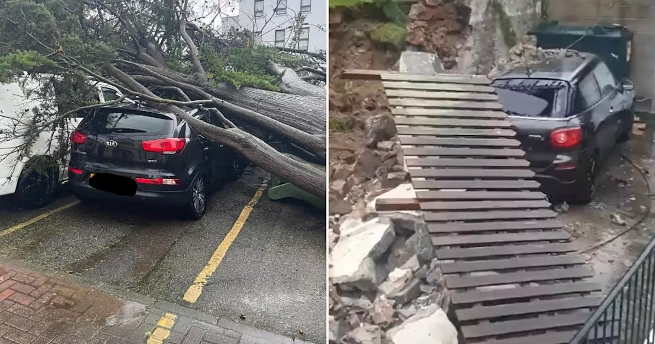
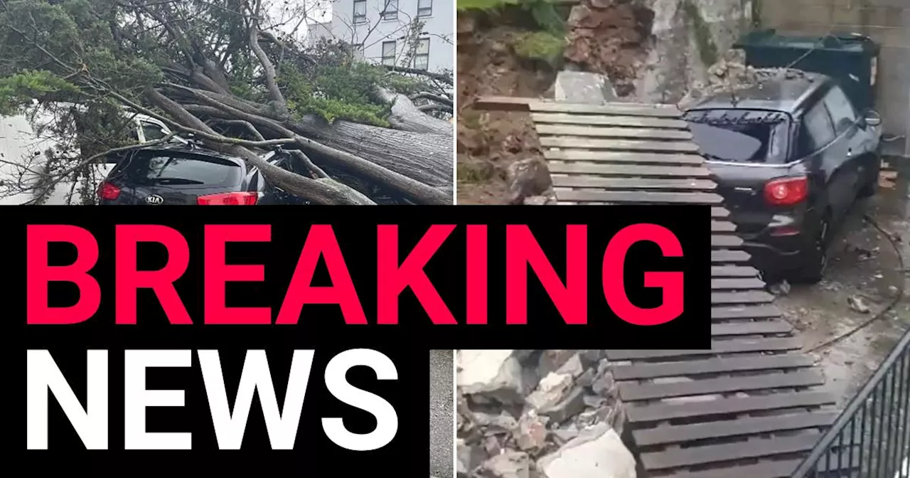
To view this video please enable JavaScript, and consider upgrading to a web browser that supports HTML5 video Jersey has been left looking like a disaster zone afte
r a tornado linked with Storm Ciarán ripped thought the island overnight. A severe thunderstorm, thought to be the worst to hit the island since 1987, tore up trees and caused massive flooding and property damage. Footage of the aftermath shows cars destroyed, roofs caved in and widespread power outages. Debris can be seen lining the streets and entire areas appear submerged. Hailstones the size of golf balls were also reported falling on the island, breaking windows and harming livestock.
The Met Office said Jersey Airport had recorded gusts of wind of up to 93mph on Thursday morning, with Langdon Bay in Kent reporting 71mph winds.
Danmark Seneste Nyt, Danmark Overskrifter
Similar News:Du kan også læse nyheder, der ligner denne, som vi har indsamlet fra andre nyhedskilder.
 Jersey looks like a disaster zone after 100mph Storm Ciaràn winds hammer islandWow.
Læs mere »
 Jersey looks like a disaster zone after 100mph Storm Ciaràn winds hammer islandWow.
Læs mere »
 Storm Ciarán: Jersey officials declare major incident as 100mph gusts of wind expectedForecasters are now predicting winds of nearly 100mph will hit the Channel Islands as the eye of Storm Ciarán arrives.
Læs mere »
 Red weather warning over Storm Ciarán 100mph 'bomb' about to hit UKParts of Britain are bracing for hurricane-force gales that could cause blackouts, cancelled flights and travel chaos.
Læs mere »
 Red weather warning over Storm Ciarán 100mph 'bomb' about to hit UKParts of Britain are bracing for hurricane-force gales that could cause blackouts, cancelled flights and travel chaos.
Læs mere »